 By
North Malabar is the stretch of Kerala that a lot of travellers still fly past on the way to Kochi, or skip on the way up to Goa. This is Kannur and Kasaragod: laterite forts above the sea, quieter backwaters than Alleppey, a beach you can drive on, a lake temple with a story that sounds made up until you stand there, and a ritual that still belongs to the villages.
I have just built an 8-day North Malabar itinerary around Theyyam and the beaches of Kannur, Thalassery and Bekal, and while putting it together I kept a list of the places that genuinely deserve a spot on your wish list. So here are the top 10 places to visit in North Malabar, counted down from No. 10 to the one experience I would never let you miss.
Top 10 places to visit in North Malabar
10. Dharmadam Island: A Green Speck Off Thalassery
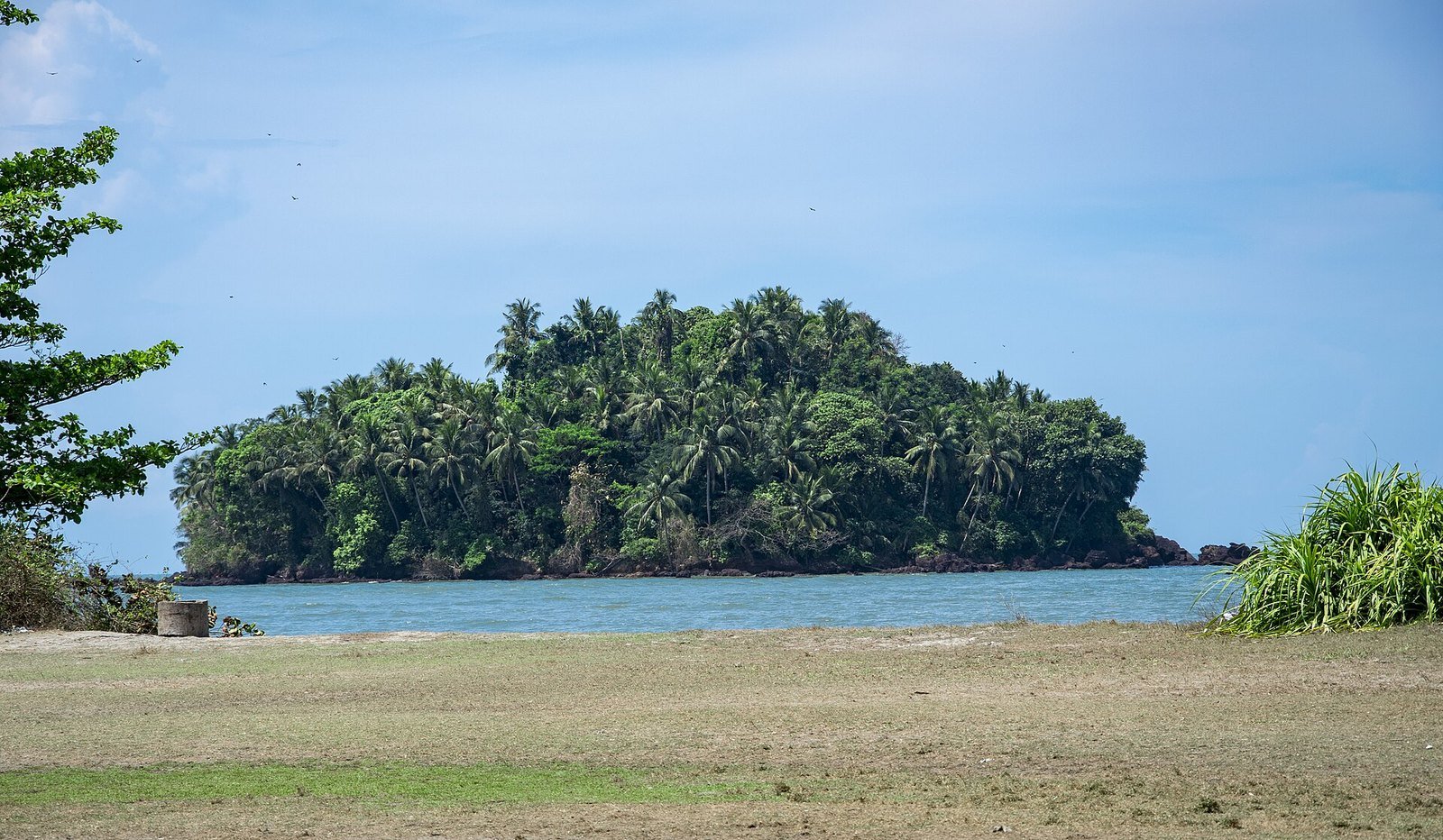
Dharmadam Island, also called Dharmadam Thuruth or Pachathuruth, is a small, uninhabited island of coconut palms and laterite rock just off the coast near Thalassery. Kerala Tourism puts it at about five acres, with the sea on one side and river water on the others, so from the shore it looks like a thick green mound in a calm channel. At low tide the water can get shallow enough to wade, which is why so many photos make it look like an easy stroll.
Here is the part a lot of posts leave out: the island is privately owned, and Kerala Tourism is clear that you should only go across with prior permission. Treat it as a view first, not as a picnic you can walk into on a whim. Even from the beach the setting is special, with the island in front of you and Muzhappilangad drive-in beach close by along the same stretch of coast. To see it on the map, click here.
9. Madayipara: The Laterite Plateau That Changes Colour
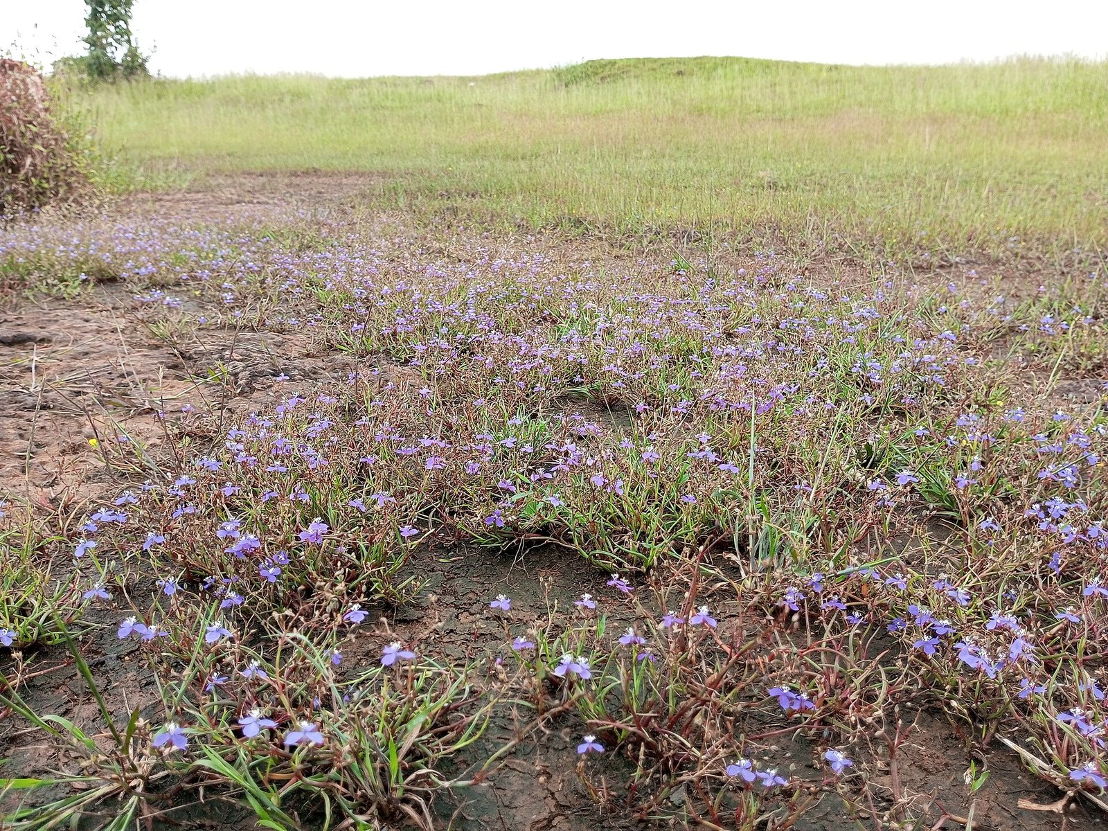
Madayipara, near Pazhayangadi in Kannur district, is not a beach and not a fort. It is a wide laterite plateau of about 700 acres, and Kerala Tourism calls it a home to more than 300 flowering plants, along with insect-eating plants. In the monsoon the plateau turns a deep green; later it can flush with small wildflowers, including a blue bloom that locals look out for, and in drier months the grass goes gold. You come here to walk and look, not to tick off a monument in twenty minutes.
The plateau also has a past. It is linked with the old Ezhimala kings, and remnants of Madayikotta, the old fort, are still here, along with a pond said not to dry even in hard summers. Nearby stand Madayi Kavu, a well-known Bhagavathi temple, and a historic mosque, so this is not only a nature walk. Wear shoes you do not mind getting dusty or damp, and go easy on the plants underfoot. To get the location, click here.
8. Arakkal Museum: The Palace of Kerala’s Only Muslim Royal Family
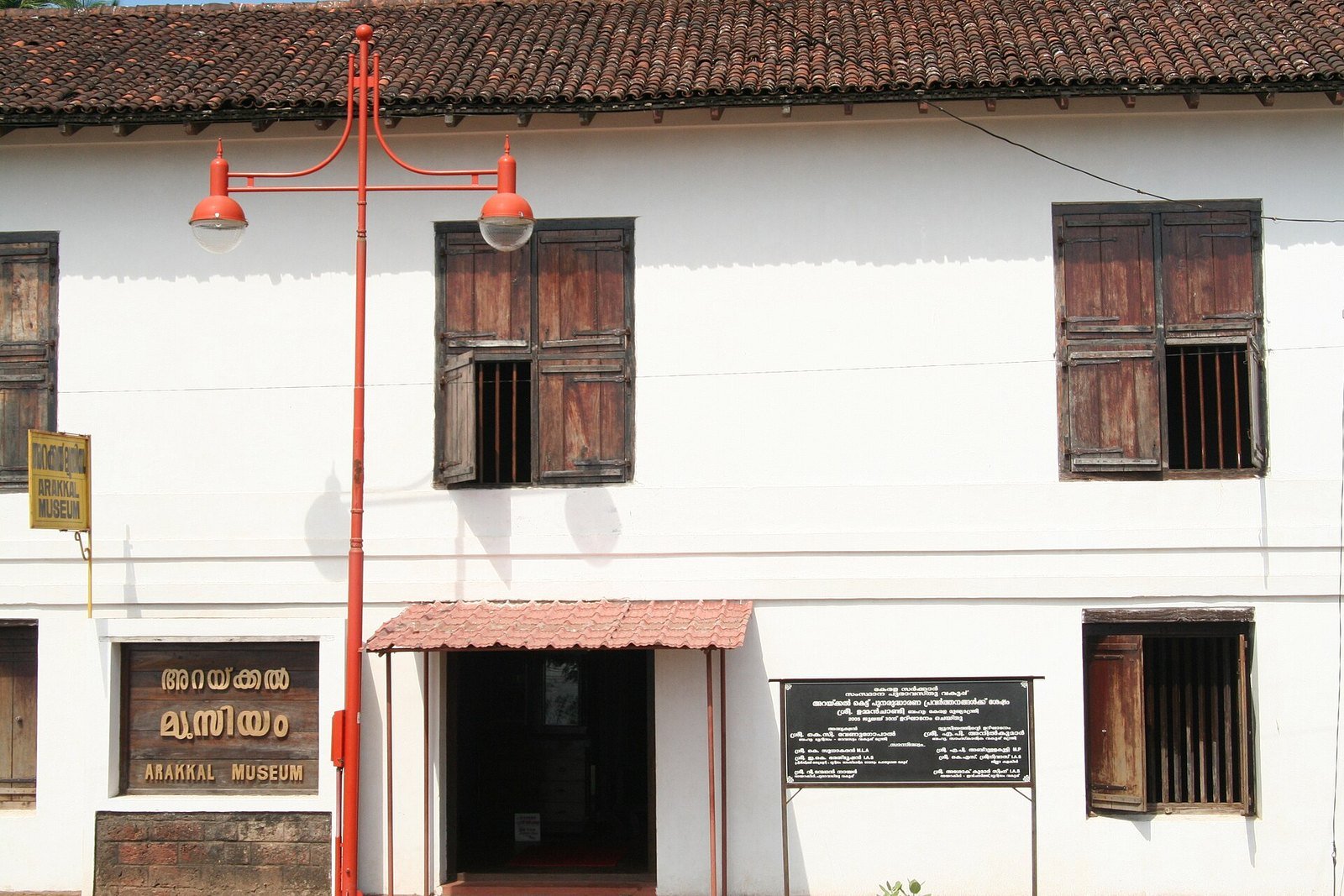
Just west of Kannur town, in Ayikkara, stands Arakkal Kettu, the palace of the Arakkal family, Kerala’s only Muslim royal house. The rulers were called Ali Rajas when the head of the family was a man, and Arakkal Beevis when the head was a woman, under a matrilineal system in which the eldest member, male or female, took the title. The building still feels like a working old house: laterite and wood, tiled roofs, wooden shutters and a quiet courtyard mood rather than a grand marble showpiece.
The durbar hall is now a museum, with family heirlooms, documents, weapons and objects from a house that traded, negotiated with European powers and ruled a small but important pocket of this coast. Give it time. The point is not a huge collection; it is that this history sits in the middle of Kannur, close to St. Angelo Fort, which the family once held as well. Dress modestly, as you would in any old palace that is also a place of memory. To find it, click here.
7. Ananthapura Lake Temple: A Shrine in the Middle of a Lake
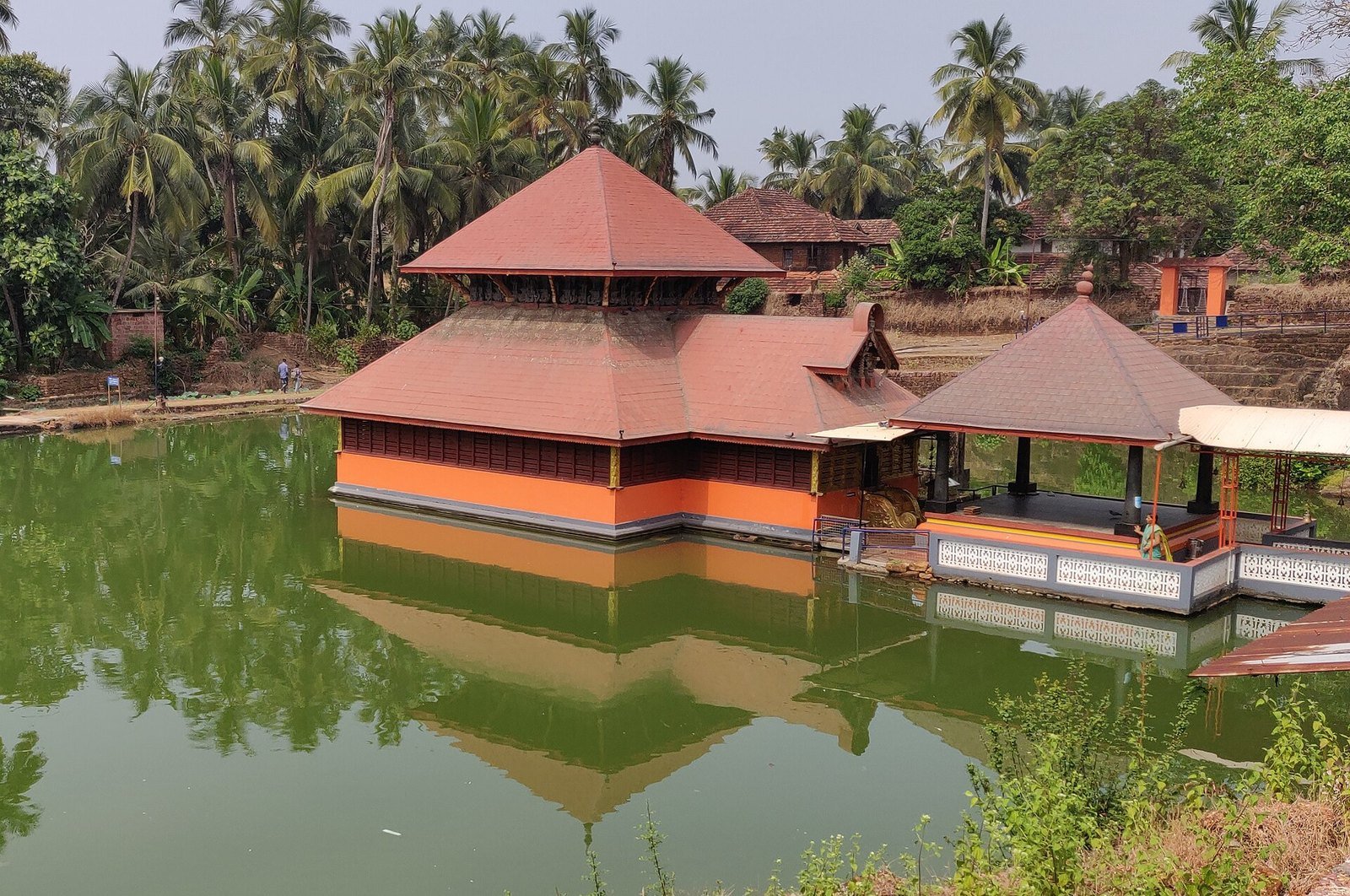
Ananthapura, near Kumbla in Kasaragod, is a temple that sits in the middle of a small lake, reached by a narrow footbridge. Kerala Tourism calls it the only lake temple in Kerala and dates the shrine to the ninth century. The deity is Vishnu, as Ananthapadmanabha seated on the serpent Anantha, and local tradition holds that this was the original seat of the deity later worshipped at Padmanabhaswamy Temple in Thiruvananthapuram. Whether or not you follow that belief, the setting does half the talking: tiled roofs, orange walls and a mandapam reflected in still green water.
Then there is the crocodile. For years the lake was known for a guardian called Babiya, fed on offerings and said never to harm anyone. Babiya died in October 2022. The local belief is that only one crocodile lives in the lake at a time, and in November 2023 a new one was reported and also named Babiya. Do not go looking for a guaranteed sighting, and do not lean over the water for a photo. Come for the temple, dress modestly, and follow the priests’ instructions. Kerala Tourism notes that the shrine is open to visitors of all castes and faiths. To get the location, click here.
6. Kavvayi and Valiyaparamba: North Malabar’s Own Backwaters
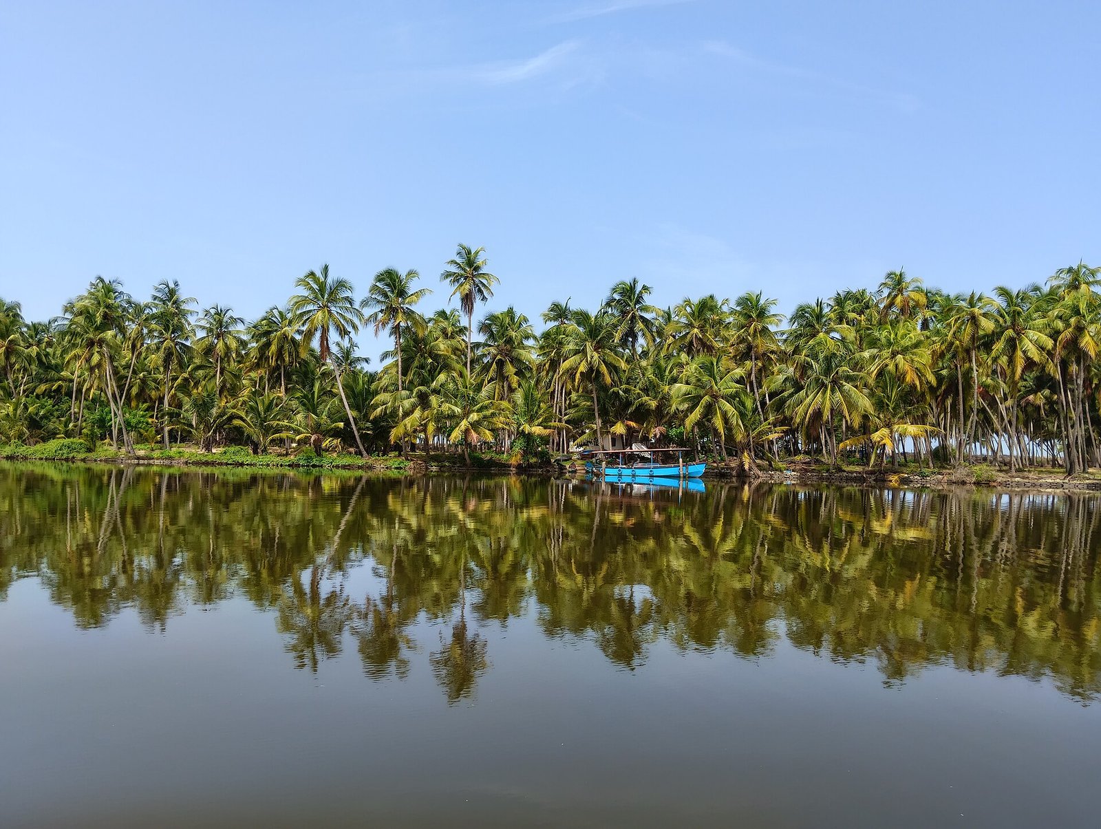
When people say Kerala backwaters, they almost always mean Alleppey, which I have also written about in my solo travel guide to India. Up here in the far north there is a quieter water world. Near Payyanur, the Kavvayi backwaters are formed by five rivers, and Kerala Tourism describes this wetland as the largest in North Kerala, about 37 square kilometres dotted with small islands. A little further south, around Nileshwar in Kasaragod, the same broad system is better known as the Valiyaparamba backwaters, which Kerala Tourism calls the third-largest backwater stretch in the state, fed by four rivers including the Tejaswini.
Valiyaparamba is also the name of the largest island in this maze, with backwaters on one side and the Arabian Sea on the other, and shores lined with coconut and mangrove. This is the place for a slow boat, or a kayak with a reliable local operator, and a lot of looking. Kerala Tourism mentions around 90 kinds of birds here. Houseboats run on these waters too, but the joy is the quiet: village life on the banks, a fishing boat under the palms, and water calm enough to hold a reflection. To see Kavvayi on the map, click here, and for the Valiyaparamba side, click here.
5. St. Angelo Fort: Kannur’s Portuguese Sea Fort
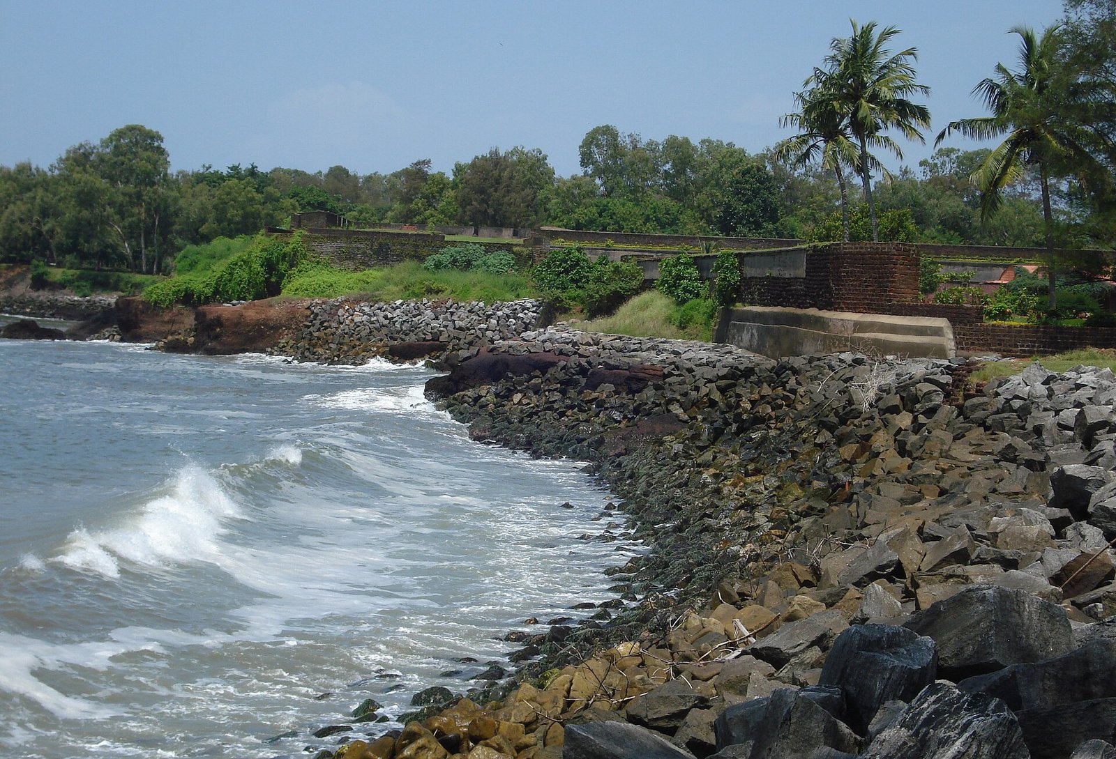
St. Angelo Fort, also called Kannur Fort, sits on a headland above the sea at the edge of Kannur town. It was built in 1505 by Dom Francisco de Almeida, the first Portuguese viceroy in India, with the consent of the local Kolathiri rulers, to guard a trading post. The laterite fort is roughly triangular, and it changed hands the way so many Malabar forts did: the Dutch took it in 1663 and reshaped it, the Arakkal family later held it, and the British captured it in 1790 and used it as a military station. Today it is protected by the Archaeological Survey of India.
What you come for now is the walk: weathered laterite walls, a moat, bastions, old munitions stores, and views over Moplah Bay, the fishing harbour and the Arabian Sea. If you like sea forts, it sits in an interesting line with Tiracol Fort in Goa and the very different island stronghold of Murud-Janjira. Go early or late if you can; the laterite holds the heat and the light on the water is kinder then. To get the location, click here.
4. Thalassery Fort and the Old Town Behind the Biryani
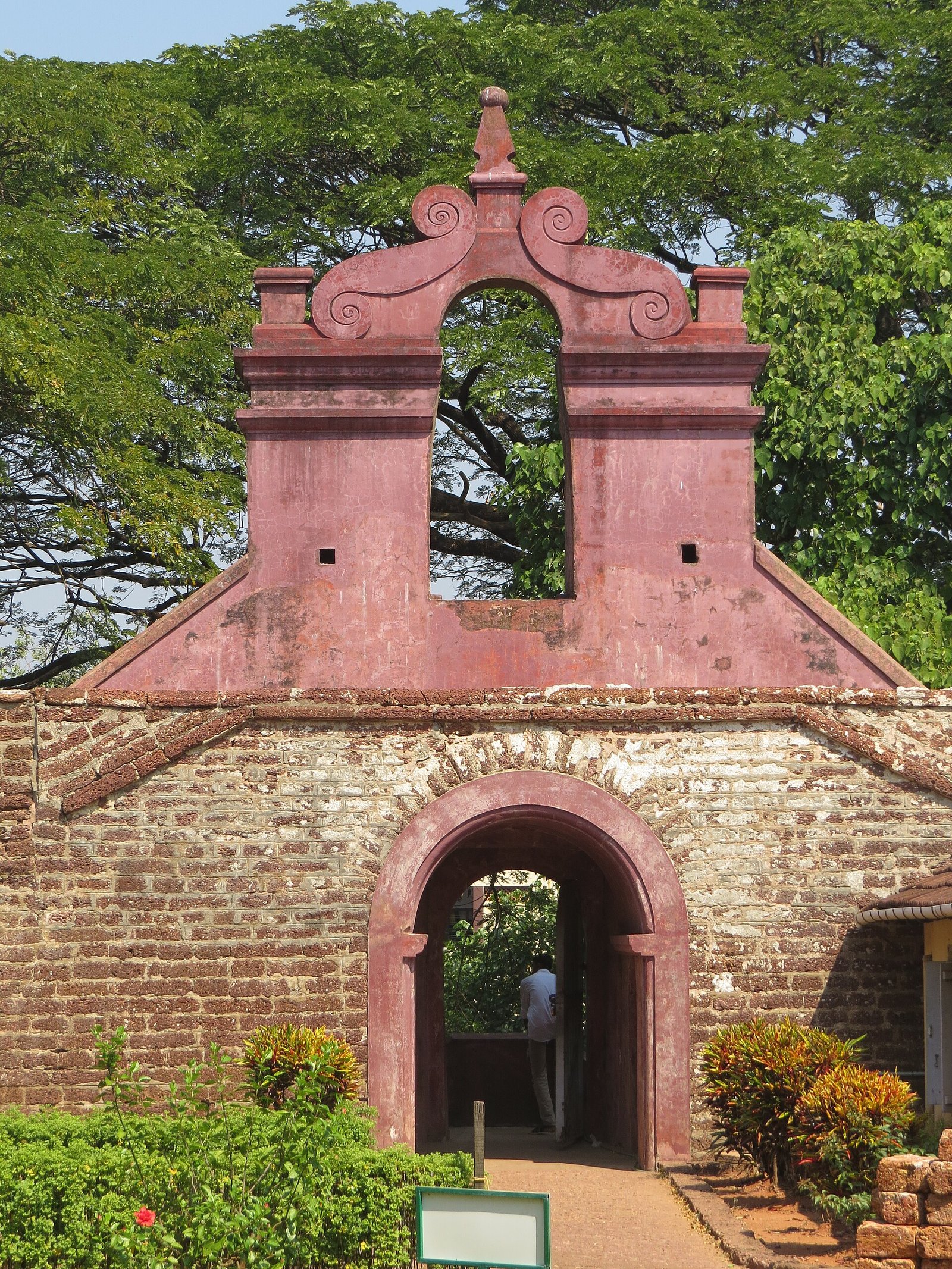
Thalassery, which older maps call Tellicherry, is the town south of Kannur that a lot of people only know for its biryani, and the biryani is worth the reputation. The town also has a real colonial core. Kerala Tourism dates Thalassery Fort to 1683, when the English East India Company built it as part of a trading factory; it later became a military and administrative base. It is a square laterite fort above the sea, cared for by the Archaeological Survey of India since 1999. The old entrance, with its red-painted pediment and arched gateway, is one of the most recognisable sights in town.
Around the fort, Thalassery still feels like a harbour town that once mattered to merchants and officials. Overbury’s Folly, a sea-facing public garden on a rocky point, is a pleasant place to sit with that view, and the streets behind the fort are where you should eat. Thalassery biryani is its own style, usually made with short-grain rice, and the wider Malabar table of pathiri, fish and coconut is the everyday reason to linger. Do not rush the town just to photograph a gateway. To find the fort, click here.
3. Muzhappilangad: Kerala’s Drive-in Beach
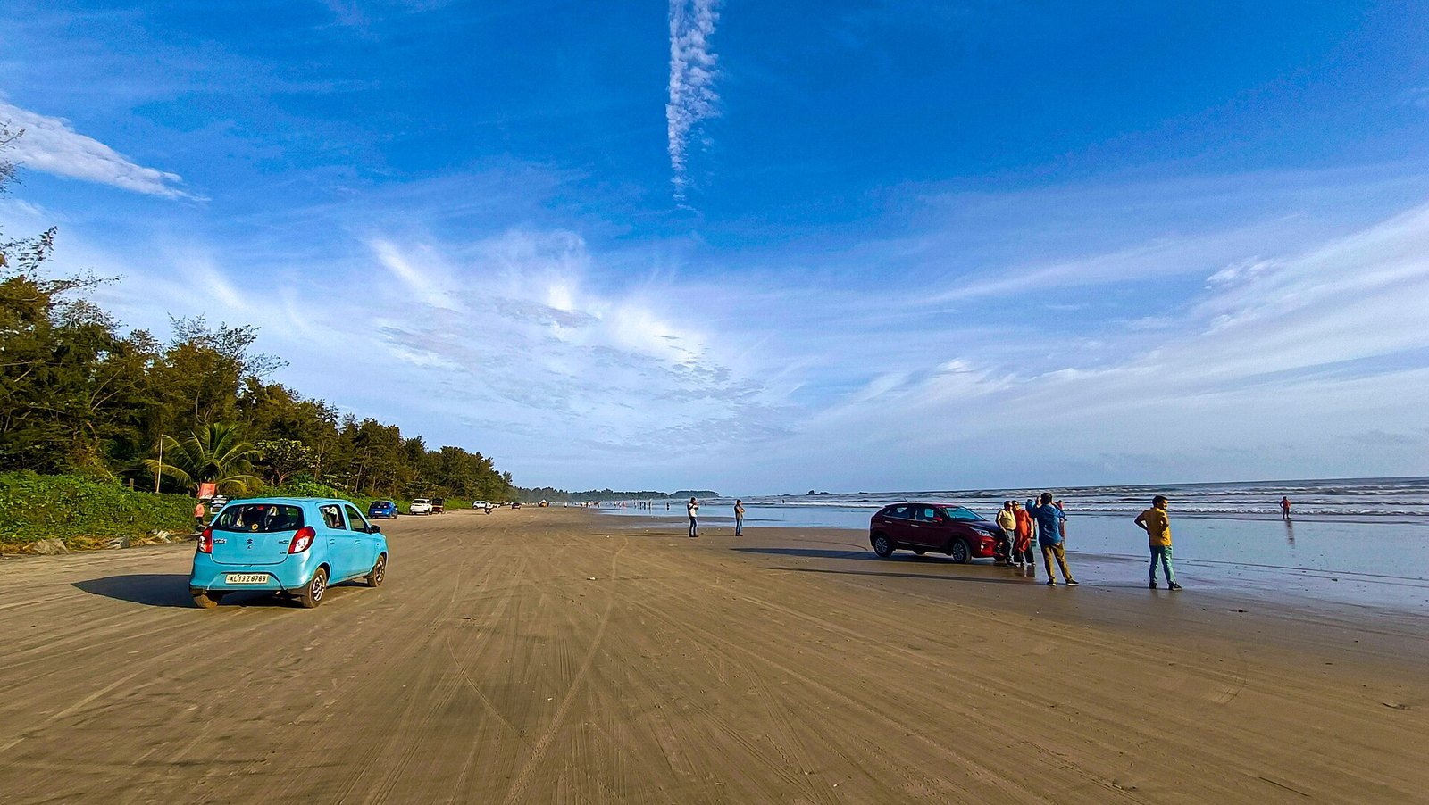
Muzhappilangad, between Kannur and Thalassery, is the beach people talk about because you can drive on it. Kerala Tourism and the local panchayat call it Kerala’s only drive-in beach, a firm stretch of sand about four kilometres long, and local rules allow vehicles along a long section of that shore, often given as about 3.4 kilometres. Black rocks along the edge break some of the force of the sea, which is why the sand stays driveable and why the water is often calmer than on a fully open beach.
A few practical things, because this is the kind of place where people get overexcited. Drive slowly, keep off soft sand, and do not leave a car standing on wet sand; it can sink. High tide eats into the width of the beach, so the drive is best when the water is lower. The rocks make the sea milder than many Kerala beaches, but this is still the Arabian Sea, so swim only where it looks sensible. Dharmadam Island sits just off this same coast, and the two places pair naturally as a view. To get the location, click here.
2. Bekal Fort: Kerala’s Largest Fort, Built for the Sea
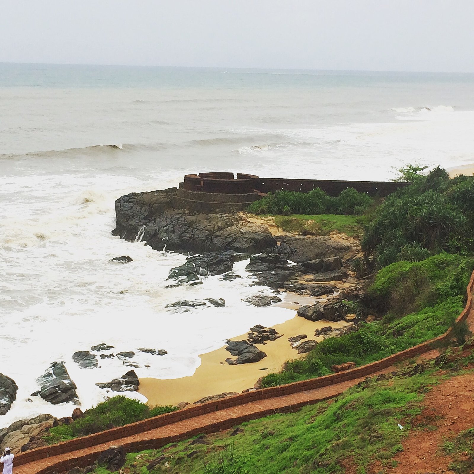
If one monument is the face of Kasaragod, it is Bekal Fort. Kerala Tourism calls it the largest fort in the state, a laterite stronghold of about 40 acres at Pallikere, with the sea washing much of its outer wall. This is not a palace fort with royal rooms to wander through. It was built as a defence work, with a zigzag entrance, a moat, a magazine, a stepped tank, tunnels, and an observation tower whose climb is the moment most people remember. From the ramparts the coast runs away in a long pale line, and the walls drop towards rocks and surf.
The history has more than one telling. The Archaeological Survey of India, which protects the fort, links the main construction to the Ikkeri or Keladi Nayakas in the mid-17th century, with Sivappa Nayaka often named as the ruler who completed it; later it passed to Hyder Ali, Tipu Sultan and the British. Other traditions point to earlier local dynasties. A Hanuman temple and a mosque stand nearby, and film fans may recognise the ramparts from the song Tu Hi Re, or Uyire in Tamil, from Bombay, which Kerala Tourism lists as a film location. I have given the fort a full post of its own, Bekal Fort: Kerala’s Seaside Giant in Kasaragod. To see it on the map, click here.
1. Theyyam in Kannur: The Ritual I Would Never Let You Miss
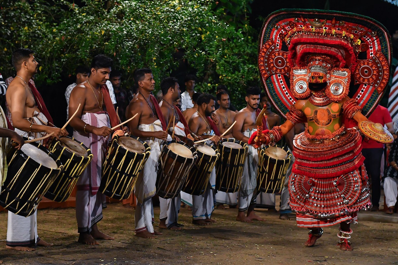
If you come to North Malabar and leave without Theyyam, you have seen the coast but missed the thing that makes this coast unlike anywhere else in India. Theyyam is not a dance show put on for visitors. It is a living temple and village ritual, performed at shrines called kavus, in which the performer, after strict preparation, takes on the presence of a deity. Kerala Tourism says there are nearly 400 different Theyyams, and the main season runs from about mid-October to late May. The heartland is Kannur and Kasaragod, with related traditions in nearby districts and over the Karnataka border.
Most Theyyam happens at night or very early in the morning, in courtyards lit by lamps and fire, with drums and a crowd that has come to pray, not to clap. The costumes are unforgettable, but the point is the moment the ritual takes over. The one place you can see a form of Theyyam through the year is Parassinikadavu, on the Valapattanam river, where Muthappan Theyyam is performed every day at the Sree Muthappan Madappura. Dawn and evening rituals are the usual pattern; confirm the time with the temple, because this is worship, not a ticketed slot. I have written a full guide to Theyyam in Kannur, including how to watch it with respect. If I had to keep only one experience from this list, this would be it. To find the daily shrine, click here.
Best time to visit North Malabar
For most travellers, December to February is the most comfortable window: drier weather, clearer skies and the heart of the Theyyam season. Theyyam itself runs from about mid-October to late May, so the edges of that season can also be excellent if you are coming mainly for the rituals, though the days get hotter towards summer. June to September is the monsoon, when the sea is rough and Madayipara is at its greenest. If your heart is set on beaches and forts, I would keep the monsoon for another kind of trip. Theyyam dates at village shrines change from year to year, so confirm closer to your travel dates.
FAQ
- What is the best time to visit North Malabar?
December to February is the most comfortable period for beaches, forts and Theyyam together. The wider Theyyam season runs from about mid-October to late May. The monsoon, from June to September, is green but wet, with a rough sea.
- Is Theyyam held all year in Kannur?
Most village Theyyam is seasonal, from about mid-October to late May. The well-known exception is the Muthappan shrine at Parassinikadavu, where Theyyam is performed every day. Confirm the dawn and evening ritual times with the temple before you go.
- Can we drive on Muzhappilangad beach?
Yes, it is Kerala’s only drive-in beach, and local rules allow vehicles along a long stretch of the sand. Drive slowly, avoid soft wet sand, and remember that high tide narrows the beach.
- Can we swim at these beaches?
You can swim in places, but this is the Arabian Sea and currents can surprise you, especially in the monsoon. Muzhappilangad is often calmer because of the rocks, but you should still be careful.
- Are Theyyam and the temples open to visitors of all faiths?
Yes, visitors of all faiths are generally welcome at the places described here if they dress modestly and behave as guests. Theyyam is a ritual, so follow what the shrine asks of you.
- How many days do you need for North Malabar?
You can taste the region in a couple of busy days, but you will only scratch the surface that way. Theyyam, the forts, the drive-in beach, the backwaters and the lake temple each need unhurried time.
Final Thoughts
North Malabar is not a highlight reel of the usual Kerala postcard, and that is exactly why I like it. You get a drive-in beach, a fort that feels as if it grew out of the sea, backwaters without the Alleppey crowd, and a ritual that can stop a whole village in the middle of the night. If I had to choose, I would build the trip around Theyyam and then let Bekal Fort and Muzhappilangad take their place around it. Which one are you more curious about, a dawn Theyyam or the walls at Bekal? Tell me in the comments. And if you are still making lists, read my guides to Theyyam in Kannur and Bekal Fort, or stay with India in my 25 best places for solo travel in India.
If Theyyam, Bekal Fort and the drive-in beach are what made your heart beat faster, I have already done the planning in my 8-day North Malabar itinerary, built around Kannur, Thalassery and Bekal. You can just use it for the days you have, book from its links and go, with no planning worries. If you want a custom version for your own dates, CLICK HERE to start on the trip form.
I plan the route. I don’t book the ferry, the stay, or the tickets. A custom plan is Rs. 200 per travel day. Fill the trip form, pay online, and I’ll send you the plan.